Services

Explore all of our commercial services

RUAS Drone Training Online
Digital Twin of King Cross station

PointCloud Surveys

A Point Cloud Survey is an advanced method of capturing spatial data with incredible precision.

A shot taken by a drone during a thermal inspection.

Thermal Inspections

Elevating inspections and surveys by capturing a fresh perspective

An airborne drone capturing aerial footage.

Video

Dynamic aerial footage that captures the perfect moment of your project

A RUAS trained drone pilot unboxing a drone to form a spectral image during an inspection.

Spectral Imagery

Adaptive and reliable data for growing site analysis.

A RUAS trained drone pilot, in a power plant using a radio controlled transmitter to fly the drone. The drone will produce an orthomasics model of the power plant.

Orthomosaics

High-quality interactive data that brings your assets into the digital age

Angel of the North Point Cloud

3D Models

Creating accurate 3D models that can show detailed insight into your assets

An airborne drone at a national trust park, producing photogrammetry images.

Photogrammetry

Create accurate point cloud for photogrammetry projects and assets safely in rapid time
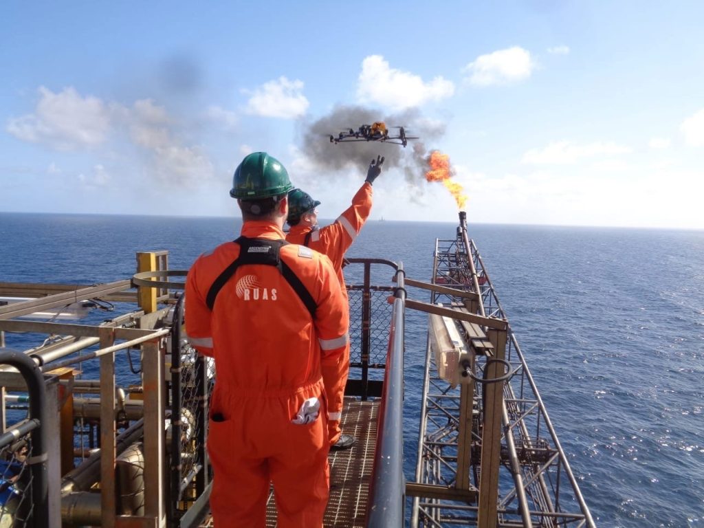
A drone shot of an oil rig, taken during an offshore survey.

Offshore Surveys

Apply the perfect solution to an offshore survey and inspections team, creating safe working practices and massive savings for clients

An aerial drone shot of a bridge being built over a river, with the city in the landscape. This was taken during a RUAS building survey.

Building Surveys

Save costs on both time and labour by applying our expertise to your needs

A drone shot of a wind turbine and the landscape behind it, during a utility survey.

Utility Surveys

Our experience and capability can be exactly what’s needed to fully capture the highlights of your scope.

Topo Survey Drone

Topographical Surveys

With trusted methods and technology to capture and process the data that’s important to you quickly and effectively

Featured Drone Services

Engineering Surveys

Capture accurate data with effective modern methods to help bring out the best in your project

An aerial drone shot of Birmingham City's rooftops.

Roof & Building

With aerial technology and drones so accessible today, roof and building inspection has never been easier and more efficient.

A close-up shot of a drone used for confined spaces.

Confined Space

Confined space areas are often considered to be the most dangerous for those involved for a great many reasons, such as exposure to asbestos and other hazardous materials, or limited areas to work in safely.

Three RUAS trained drone pilots stood on an oil refinery taking aerial imagery.

Non-Destructive Testing

Providing risk-mitigated methods with a fast and effective process.

Visual Bridge Inspection

Visual Inspections

Take advantage of our quality aircraft and advanced permissions to capture imagery for visual inspections in any environment

An airborne drone during a GVC transition training course.

Can we help you with your drone service needs?

Contact Us

By submitting this form you agree to the adaptable privacy policy & consent to your contact details being collected.

This website uses cookies to ensure you get the best experience on our website. Learn More